
Scientists from the Wildlife Conservation Society (WCS), with funding from NASA, have released new research showcasing an innovative approach to mapping wildlife habitat that combines field data, satellite imagery, and expert knowledge.
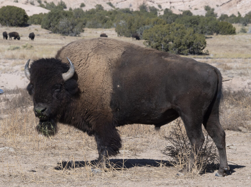
The study introduces dynamic, updateable datasets that visualize past, present, and future habitat availability for four globally significant species: the tiger, American bison, jaguar, and African lion.
The new datasets build on earlier tiger habitat mapping work published in Frontiers in Conservation Science and respond to a long-standing challenge in conservation planning—understanding how species habitats are changing over time.
“Understanding the status of species is a major challenge for conservation,” said Dr. Rachel Neugarten, project co-principal investigator and Executive Director of Conservation Planning at WCS. “We need to know whether wildlife habitat is improving, declining, or stable, and where there are opportunities for restoration. Shockingly, for most species globally, we still don’t have that basic information.”
Species range maps are a cornerstone of conservation decision-making, guiding governments, NGOs, and funders on where to focus protection and restoration efforts. However, traditional range maps are often static, costly to update, and may reflect historical distributions rather than areas where suitable habitat still exists today. As habitat loss accelerates, these limitations reduce their effectiveness for modern conservation needs.
To address these gaps, the research team developed the Act Green approach, which produces dynamic, open-source maps capable of identifying landscapes with current and future potential for species recovery, restoration, and rewilding. The tool integrates remote sensing data, field surveys, and expert input to create global-scale habitat assessments that can be updated as new information becomes available.
“These free, open-source maps are already being used by WCS, WWF, Panthera, range-state governments, and researchers to guide conservation investment, rewilding, and field surveys,” Neugarten added.
A key innovation of the study is the incorporation of future projections from the Human Footprint Index, a WCS-developed measure of human influence derived from satellite imagery. By forecasting changes in human pressure, the maps help pinpoint areas where habitat loss is imminent as well as landscapes where restoration efforts are most likely to succeed.
“The real strength of this work is that the maps are both data- and expert-driven—and fully updatable,” said Dr. Jay M. Schoen, a jaguar researcher and geospatial data scientist with the Western Fire and Forest Resilience Collaborative at the Cary Institute, who served as the project’s technical lead. “By combining modern geospatial tools with the work of partners on the ground, we can track progress for these flagship species and others that share their ranges.”
The research is also positioned to support global biodiversity targets. As countries work toward the 2030 goals of the Kunming-Montreal Global Biodiversity Framework under the Convention on Biological Diversity, conservation planners require reliable, forward-looking scientific data to prioritize investments.
“These maps deliver exactly that—and provide a powerful, efficient framework that can be extended to many other species,” said Dr. Gautam Surya, project co-principal investigator and Conservation Planning Scientist at WCS.
NASA emphasized the broader value of the work in aligning space-based observation with on-the-ground conservation outcomes. “This groundbreaking work shows how NASA’s satellite observations, combined with field expertise, can create dynamic tools that don’t just map where threatened species exist today, but predict where habitat will be viable tomorrow,” said Laura Rogers, Associate Program Manager for NASA’s Ecological Conservation Program.
Conservation practitioners have also welcomed the tool’s practical applications. “Act Green provides a user-friendly, science-based platform to assess changes in species habitat over time and orient conservation efforts toward areas facing higher levels of threat,” said Valeria Boron, Science Lead for WWF’s Jaguar Initiative. “For jaguar conservation, this tool is critically important for delineating priority landscapes and assessing the collective impact of regional conservation efforts.”
The project was funded by NASA under grant 20-ECOF-20-0011 and conducted in partnership with WWF, IUCN, SparkGeo, and the SILVIS Lab at the University of Wisconsin–Madison.
